Tuesday, February 5, 2013

Day 10

Today we are going to sample some of the best wines that the Marlborough region has to offer.  We chose a group called Bubbly Grape to be our guides, and most importantly our drivers.  We were surprised when Jonathon showed up and we were the only ones going out on the tour.  This led to a very fun and informative day, as he could focus his entire efforts towards our desires and questions.  Great fun!


There are some 40 odd wineries in the area, 20 or so with cellar doors.


Montana Brancott Estates was one of the first wineries in the region and is now one of the largest.  They used this rifle site to ensure that the vines were planted in a perfectly straight row.  Seems to have worked well.


The sheer number of plantings is beyond belief.  If I remember correctly, there are some 350 thousand individual vines planted in Marlborough.  They appear to go on forever.  There are small windmills in the background, pretty hard to see, that we thought were used for irrigation.  In actuality, they are used to move the air to keep the frost from settling on the plants.  In addition, they use over 100 helicopters on the frostiest of nights, as well as, smudge pots.

We visited 6 wineries, a couple also produce olive oil, and a chocolate factory on the tour and had a beautiful meat and cheese platter for lunch; Lawson's Dry Hills, Brancott, Spy Valley, Giesen, Bladen, and Bouldevines.  We left at 10AM and got back around 4:30PM. Thank god, we were up to the task!


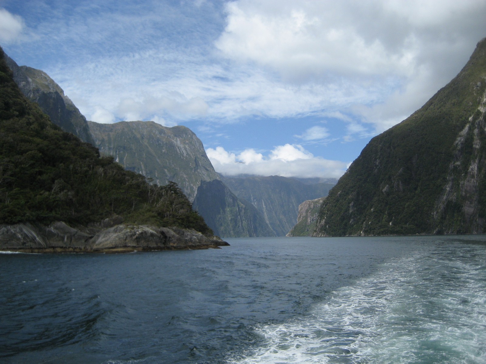
Tomorrow, we cross the Cook Straits and head back home.  We'll spend the night in Taupo, and then drive the rest of the way on Tuesday.  That's it for this year's trip.


Monday, February 4, 2013

Day 9

The trip from Greymouth to Westport along the surf-pounded coastline offers fine Tasman Sea views; so fine that Lonely Planet’s Blue List dubbed the West Coast highway one of the planet’s 10 best road trips. Fill up in Runanga if you’re low on petrol – there’s no fuel until Westport, 92km away, and the next ATM after Greymouth is also in Westport.  The main attractions along this stretch are the geologically fascinating Pancake Rocks at Punakaiki.  The coast is awash with iron clad sand and at times the road runs hundreds of feet above the thunderous Tasman sea. This road juts inland at times through beautiful untouched forests but mostly follows the roars and sights of the sea.

We have been on the Pacific Coast Highway in California and The Road to Hana in Hawaii, but his route is every bit, if not more, beautiful!


The blow holes create beautiful rainbows as the tide surges in and up through the holes.

Cape Foul Wind seal colony.

We love this signage.  Leaves nothing to the imagination!


Red deer farms are very prevalent throughout New Zealand.  Not only are they sold for meat, but deer velvet is renowned to have incredible healing and medicinal properties.  Korea is a big market for the deer velvet.


After a long days drive, a relaxing dinner riverside in Blenheim.  Tomorrow we are on a wine tour in the most famous wine region in New Zealand.


Friday, February 1, 2013

Day 8

Today we leave Queenstown and head north back towards the Southern Lakes Region.  Route 6 will take us up and over the Southern Alps and up the west coast to the city of Greymouth.  It is hard to really understand the roads here without seeing them for yourself.  When you look on the map you see these wide red lines and naturally equate them to what you are used to in the U.S.  The best way I can describe most of the roadways here is that they are like well maintained narrow two-lane country roads in the U.S., with an occasional 1 kilometer passing lane.  Additionally, they often cling to the side of nearly vertical cliffs as they wind their way through the countryside.  Because of the dramatic topographical changes of the country, and the often wild weather extremes, it can make for some interesting driving challenges.  As I have said before, many times bypassing a problem may require a day's drive, if it is even possible.

Prior to leaving on our trip, we had to change our planned routing because torrential rains had washed out a bridge on Route 6 south of Greymouth.  That was repaired within about three days, but the weather that had pretty much washed out our last two days in Queenstown, had closed the route up and over the mountains.  A check of the Department of Transportation website this morning says the road is open, so we are going to give it a go.  The road north of Wanaka takes us between lake Hawea on our right and Lake Wanaka on our left.

Lake Hawea

Lake Wanaka

Because of all the rain, the waterfalls were gushing at maximum flow.


We probably encountered four or five major slips that were in various stages of being cleared.  We also went through and area of minor flooding.  Not a trip for the faint of heart!


Finally we reached the coast and the small town of Haast.  The west coast of the South Island is known for many things, including the Whitebait Patty.  Whitebait is a bit of a delicacy in New Zealand, and whitebait from the West Coast of the South Island is the best. The idea is to have more whitebait than batter, however if you go to a restaurant you will probably find that it's the other way round! West Coasters also serve them with mint sauce which is very tasty.  Our view is, "when in Rome..."  Ours was more like very tiny minnows cooked in a scrambled egg.  Not fishy!


The remainder of the drive into Greymouth was uneventful and uninspiring.  We'll overnight here and then drive over to Blenheim and the Marlborough wine country tomorrow.

Thursday, January 31, 2013

Days Six and Seven

And so this pretty much describes all of Wednesday and half the day on Thursday.  Good for Paradise Ducks but not very good for us.


Finally, a bit of hope Thursday early afternoon.


Bec, Ken and I headed off to play Arrowtown Golf Club.  It's about 30 minutes north of Queenstown.  Arrowtown is an old gold mining town, set in a pretty valley up in the mountains.  The course was a tad on the funky side, but oh so beautiful!!!


Looking back across the course and up into the mountains.

There will be no charge for any golf lessons.  Bec ready to drive on number 9 with Ken looking on.

Looking back at the number 9 tee box.

We got 13 holes in and then the cold rain started again.  An early dinner, pack up, and get ready to head across the Southern Alps and up the west coast to Greymouth tomorrow.

Monday, January 28, 2013

Milford Sound

ABOUT MILFORD SOUND (Piopiotahi)

The World Heritage Fiordland National Park and the breathtaking Milford Sound are located in the  southwest part of New Zealand’s South Island Milford Sound is a place of inspiring landscape, dramatic rivers and cascading waterfalls. Despite being one of the most accessible fiords, Milford Sound remains quiet and still, bounded by steep cliffs and dense rainforest. Rain or shine, Milford Sound continues to captivate even the most traveled.

At the pinnacle of Milford sound is the magnetizing Mitre Peak - standing a proud 1,692 metres (5500 feet) above sea level it is certainly an impressive sight to behold. The Milford Sound is by far the best known of all of the fiords in New Zealand and the only one that can be accessed by road. It is approximately 16km (9.9 miles) from the head of the fiord to the open sea, which means visitors can comfortably travel the length of the fiord to open ocean and return on one of the many cruise options.


The History of Milford Sound

Maori are believed to have discovered Milford Sound more than 1,000 years ago, returning seasonally to the fiord, collecting the much prized pounamu (greenstone). These treks from the east used traditional pathways across passes such as MacKinnon Pass on the Milford Track. The Maori named the sound Piopiotahi after the thrush-like piopio bird, which is now extinct.

In 1912 John Grono was the first European settler to land in the sound. He named Milford Sound after Milford Haven in Wales, while the Cleddau River which flows into the sound is also named for its Welsh namesake.


Maori Myth & Legend

The Maori name for Milford Sound, Piopiotahi, means "a single piopio", harking back to the legend of Maui trying to win immortality for mankind - when Maui died in the attempt, a piopio was said to have flown here in mourning.

According to Maori Legend, Piopiotahi was carved out by Tu-te-raki-whanoa, an atua (godly figure) who was given the task of shaping the Fiordland coast. Chanting a powerful karakia (prayer), he hacked at the towering rock walls with his toki (adze) called Te Hamo.


Flora & Fauna

The underwater environment in the fiords is one of the most intriguing and unique in the world. This is not only because of the beautiful natural environment and the marine reserves that exist here, but also because of an interesting effect of the high rainfall in the area. As rainfall drains through the lush forests, it becomes stained with tannins until it is the colour of strong tea.

The fiords support the world's biggest population of black coral trees - about seven million colonies, some of them up to 200 years old. They are home also to brachiopods; primitive clam-like animals that have been bypassed by evolution, remaining unchanged in over 300 million years. Bottlenose dolphins, New Zealand fur seals, Fiordland Crested Penguins and little penguins are also resident in the fiords.


Geology

Milford Sound, located at the northern most end of Fiordland National Park on the South Island of New Zealand, is a national icon. In places as much as 400 metres deep, celebrated for its pristine landscapes, and remote and rugged beauty, it is actually a fiord, rather than a sound. A river formed valley subsequently flooded by the sea is called a sound, however, Milford Sound was formed by the erosive effects of a glacier and is more correctly a fiord.

Named after its resemblance to a bishop’s mitre (head-dress), Mitre Peak is a prominent peak on the south shore of Milford Sound. Rising 1692 metres, seemingly sheer above the Sound, the summit actually consists of five closely grouped individual peaks.


The Climate

With a mean annual rainfall of 6,813 mm (268 inches) on 182 days a year, a high level even for the West Coast, Milford Sound is known as the wettest inhabited place in New Zealand and one of the wettest in the world. Rainfall can reach 250 mm (10 inches) during a span of 24 hours. The rainfall creates dozens of temporary waterfalls (as well as a number of major, more permanent ones) cascading down the cliff faces, some reaching a thousand metres in length. Smaller falls from such heights may never reach the bottom of the sound, drifting away in the wind.

Accumulated rainwater can at times cause portions of the rain forest to lose their grip on the sheer cliff faces, resulting in tree avalanches into the sound. The regrowth of the rain forest after these avalanches can be seen in several locations along the sound.


 With Mitre Peak in the background, our tour boat approaches the dock to pick us up.


Although one of the most visited sites in New Zealand, the facilities are surprisingly small.


When Becky and I went to the Grand Canyon several years ago, we took tons of pictures only to return home and find out they all looked pretty much the same.  This may be another of those situations.  But we are going to put up a bunch.

Bowen Falls


Stirling Falls.  We'll come back.

Approaching the end of the Fiord and entering the Tasman Sea.

Looking back into the Fiord.

Looking back from the sea, you can see why many explorers passed on by not realizing the Fiord even existed.

Yes this is the two hearty adventurers with Dale Point in the background.

The legend is that women touched by the spray of Stirling Falls will wake in the morning looking 10 years younger.  Never one to challenge legend, I made sure I tagged along.  Just in case!


Seal Point

Fairy Falls and Bridal Veil Falls.

 Mount Kimberly (Lion Mountain)


And so we bid farewell to Mitre Peak and Milford Sound.  We arrived back in Queenstown at about 8:15 PM.